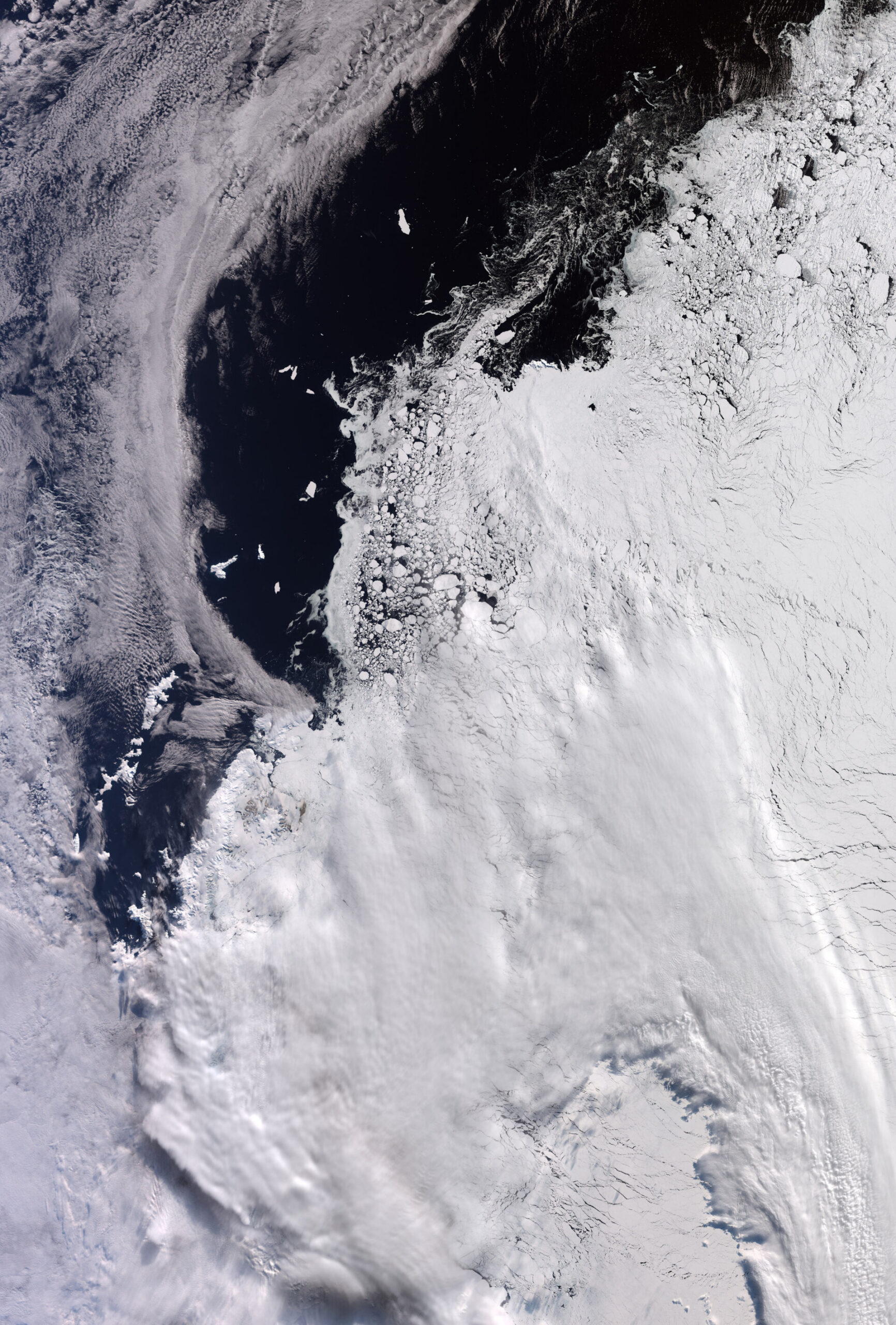
The European Space Agency’s (ESA) Copernicus Sentinel-3 satellite has delivered a breathtaking image of Western Antarctica, showcasing the continent’s grandeur at the close of the Antarctic winter. Taken on September 30, 2026, the photograph captures the annual peak of sea ice coverage, extending all the way to the Antarctic Peninsula. This striking visual not only offers immense aesthetic appeal but also provides invaluable data for scientific research into climate change and the planet’s ice cover status.
Antarctic Peninsula and Sea Ice: A Seasonal Snapshot
The image, spanning approximately 1,200 by 1,700 kilometers, clearly depicts the sea ice encircling the edge of the Antarctic Peninsula, encroaching into the waters of the Weddell Sea to the east. According to the National Snow and Ice Data Center (NSIDC), the Antarctic sea ice extent typically reaches its peak around September 14th. While clouds obscure the upper portions of the image, the lower region vividly illustrates the expansion of the icy mantle.
Diverse Ice Formations and Island Landmarks
The varied textures within the image suggest different types of ice, ranging from tightly packed ice floes on the right to vast ice fields comparable in size to Elephant Island. Elephant Island, about 50 kilometers long, is clearly visible against the ice-free water on the left. It is located approximately 930 kilometers from the edge of the Tierra del Fuego archipelago, which is not included in the frame. These details enable scientists to gain a deeper understanding of the dynamics and scale of sea ice formation and melt, crucial for climate change predictions.