Just two weeks after its successful launch, the European Space Agency’s (ESA) new Sentinel-3C satellite has beamed back its inaugural images and data, marking a significant milestone. These first glimpses of our planet confirm the satellite is in prime condition and ready to join its constellation in a crucial mission to monitor Earth’s oceans, land, ice, and atmosphere. The initial data includes breathtaking views of Italy, the Arctic, and the Caribbean, alongside vital measurements of ice sheet and sea surface heights, underscoring the satellite’s immediate value for environmental science and climate change research.
A New Eye on Earth’s Vital Signs
As the latest addition to the Sentinel-3 program, Sentinel-3C is designed to provide continuous, long-term environmental data essential for a wide array of applications. The Sentinel-3 constellation acts as the workhorse for Copernicus, the EU’s Earth observation program, equipped with a comprehensive suite of instruments to systematically observe key aspects of our planet. These observations are critical for understanding dynamic processes such as marine pollution, the impacts of marine heatwaves, and the spread of drought and wildfires. Furthermore, Sentinel-3 data helps map land use, assess vegetation health, and track changes in the height of rivers, lakes, and polar ice sheets. The data also plays a vital role in near-real-time weather forecasting and in tracking the long-term shifts associated with climate change.
Early Visuals Reveal Earth’s Diversity
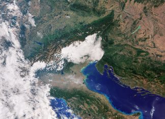
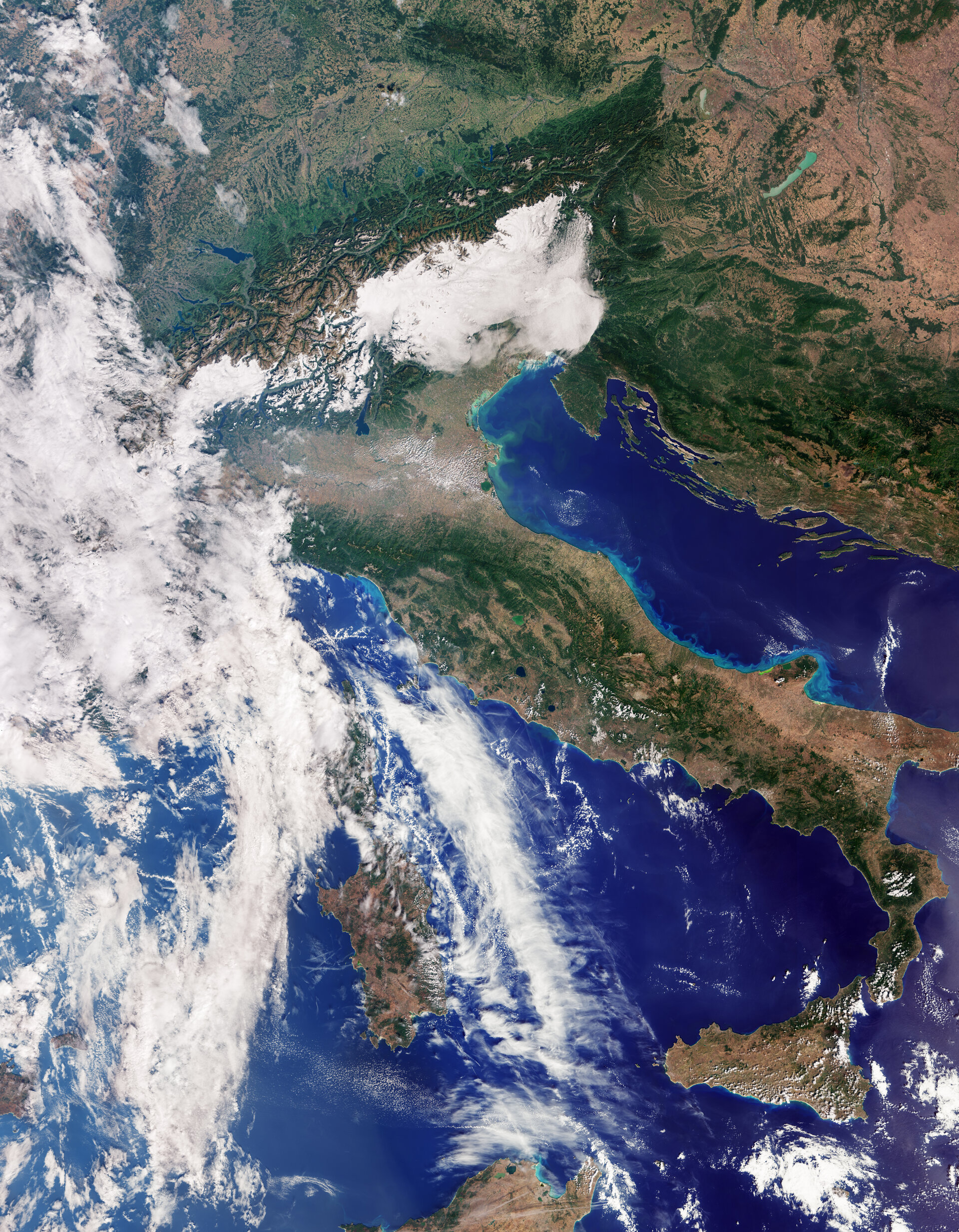
The first images from Sentinel-3C, captured by its Ocean and Land Colour Instrument, offer a vivid testament to its capabilities. A striking natural-color view showcases Italy in remarkable detail, extending from southern Germany down to Sicily. The fertile Po Valley, Italy’s agricultural heartland, is visible in shades of brown and green, contrasting dramatically with the snow-capped Alps to its north. Variations in land cover across the peninsula are evident, while the Adriatic Sea to the east reveals subtle color shifts likely due to river sediment. The darker Tyrrhenian Sea to the west encircles Sardinia and Sicily, with Cuba and the Bahamas appearing in a subsequent Caribbean image, showcasing turquoise shallows against deeper ocean waters. Another image presents the stark, icy landscapes of the Canadian Arctic Archipelago, highlighting the intricate coastlines and the presence of fractured sea ice, a critical indicator of Arctic warming.
Precise Measurements for Climate Action
Beyond visual imagery, Sentinel-3C’s Synthetic Aperture Radar Altimeter is already delivering crucial measurements. Early data comparing sea-surface heights across the Atlantic and Mediterranean Seas with existing Copernicus data demonstrate its high precision and performance, comparable to established missions. This instrument is vital for monitoring global sea-level rise, a key indicator of climate change. The altimeter will also track changes in the height of lakes, rivers, and polar ice sheets. An animation depicting measurements of the Greenland Ice Sheet’s elevation further confirms the altimeter’s accuracy, with its tracks closely aligning with reference models. Monitoring these ice sheets is paramount for understanding their contribution to sea-level rise and improving future climate predictions, providing invaluable data for mitigation strategies and global climate action.