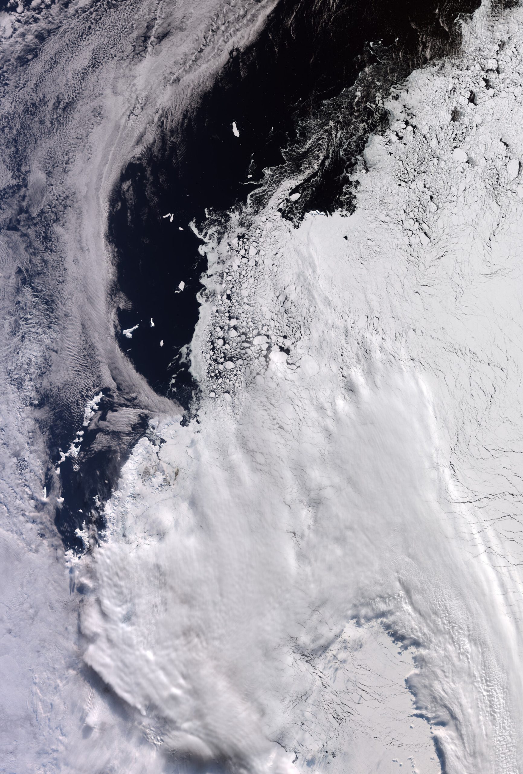
The European Space Agency’s Copernicus Sentinel-3 satellite has captured a breathtaking image of West Antarctica, showcasing the vast expanse of sea ice at its annual maximum extent as winter draws to a close in the Southern Hemisphere. This striking view, taken on September 30, 2026, offers a crucial glimpse into the dynamics of polar ice, vital for understanding global climate patterns and their impact.
A Frozen Frontier: West Antarctica Under the Ice
The image, spanning an impressive 1200 km by 1700 km, highlights the periphery of the Antarctic continent. As winter reaches its zenith, sea ice has surged outward, engulfing the northern tip of the Antarctic Peninsula and extending into the Weddell Sea. While clouds partially obscure some areas, the sheer scale and texture of the ice are clearly discernible. The National Snow and Ice Data Center (NSIDC) confirmed that Antarctica’s sea ice likely peaked around September 14, 2026, a date coinciding with this remarkable observation.
Navigating the Antarctic Landscape
Several key features are visible within this icy panorama. Elephant Island, a prominent landmass approximately 50 km long, stands out against the relatively ice-free ocean on the left side of the image. This island is situated about 930 km from Tierra del Fuego, the southern tip of South America, which is not depicted here. The Sentinel-3 data reveals a spectrum of ice conditions, from densely packed floes to smaller, swirling fragments scattered across the ocean’s surface. Some of these ice formations are comparable in size to Elephant Island itself, illustrating the immense scale of Antarctic sea ice.