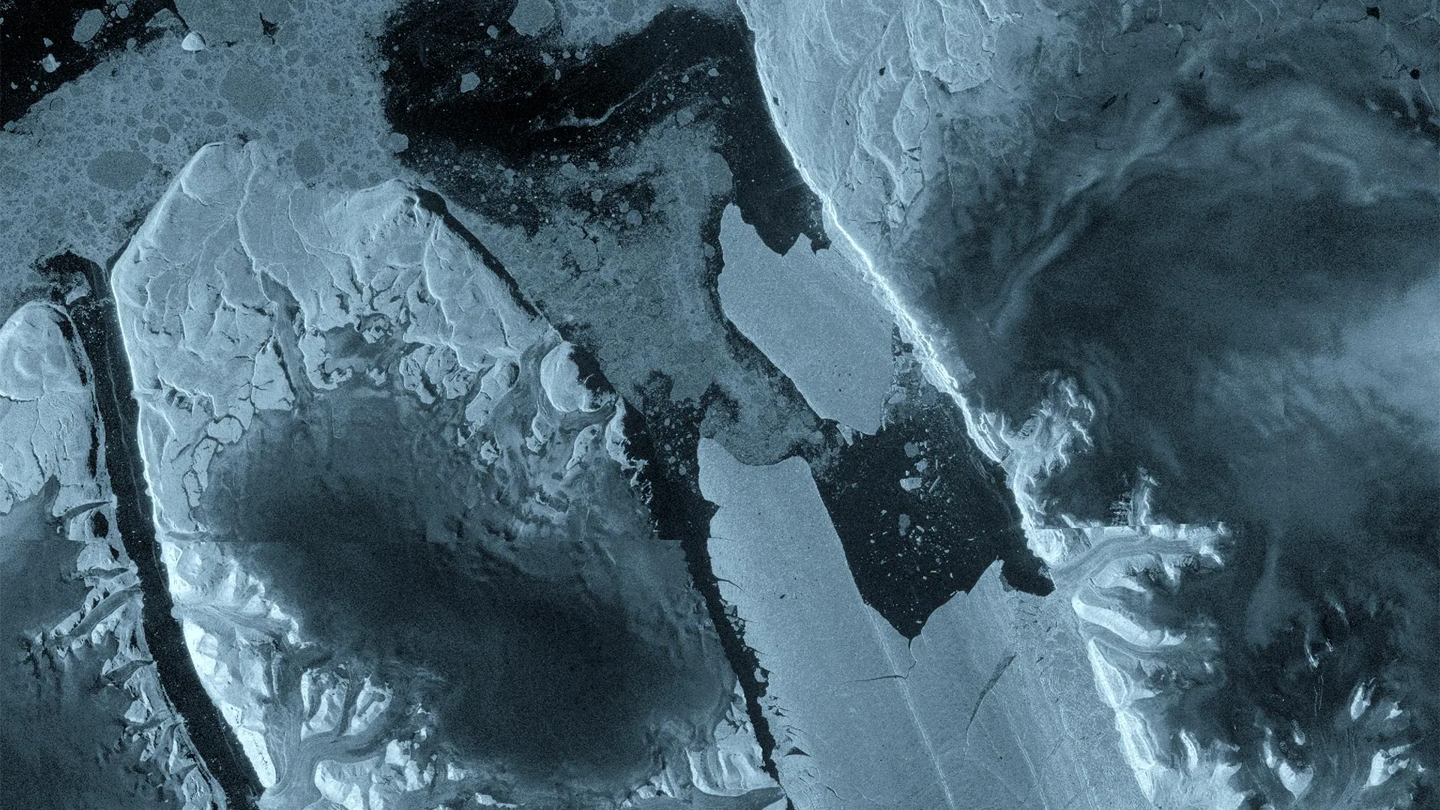
A colossal iceberg, roughly the size of Manhattan, has calved off the Petermann Glacier in northwest Greenland. The dramatic event, detected on August 4, 2026, resulted in the detachment of a 76 square kilometer ice chunk, approximately 150 meters thick. This marks the largest ice loss from the Petermann Glacier since 2012 and the most significant ice disintegration event in the Arctic since 2020.
Satellite Surveillance Reveals Major Ice Calving
The European Space Agency’s (ESA) Copernicus Sentinel-1 satellite provided crucial monitoring that captured the significant icefall. Equipped with a synthetic aperture radar (SAR), the satellite is capable of imaging through darkness and cloud cover, making it ideal for observing remote polar regions. Radar images from August 3rd already indicated significant damage to the glacier’s ice tongue center line. By August 4th, a massive iceberg had broken free from the eastern side of the glacier, forming a free-floating, flat-topped ice island that is now drifting into the Arctic Ocean.
Potential for Further Breakage
Scientists are closely watching the Petermann Glacier, as satellite imagery suggests the possibility of further ice loss. Analysis indicates that two additional large ice masses, measuring approximately 97 square kilometers and 87 square kilometers, could also break off in the future as existing cracks expand. This ongoing instability highlights the dynamic nature of polar ice sheets and their vulnerability to environmental changes.
Monitoring and Risk Assessment
Canadian authorities are actively tracking the trajectory of the newly formed iceberg. They are also conducting an assessment of the potential risks it poses to shipping lanes and offshore facilities in the region. The movement of such large ice formations can significantly impact maritime navigation and industrial operations in the Arctic.
The Petermann Glacier is one of Greenland’s largest outlet glaciers and has been a subject of scientific interest due to its significant ice discharge into the ocean. Events like this calving underscore the importance of continuous satellite monitoring for understanding ice dynamics and their potential impact on sea levels and climate patterns.