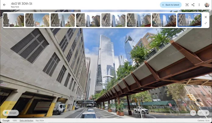
Google Earth is celebrating its 20th anniversary, and to mark the occasion, Google is adding historical street views to the service. In a blog post, Google said that the anniversary update allows users to “explore the wonders of the planet from even more perspectives, whether it’s a bird’s eye view or street level.”
Starting today, when you load Google Earth, you’ll see a new Historical Images option in the toolbar that lets you move back and forth between the present and past years. Anticipating that you might be overwhelmed by the prospect of having the entire planet at your fingertips, Google offers some tips. You might want to look at a timeline of Berlin from 1943 to the present day, when the Berlin Wall was built and fell, before the city underwent a huge urban transformation. You can also watch the rapid expansion of Las Vegas since the 1980s, or how the NRG Stadium in Houston was built on a site that was just an agricultural plot in 1944. Some Maps users have even used Historical View to find, for example, photos of their homes from years past, sometimes finding images of lost loved ones in the process.
Google also announced further updates to Google Earth, including new AI-powered insights for professional users in the United States. City planners will soon be able to access information about things like tree coverage and ground surface temperature in different parts of the city using Gemini’s built-in data.
Google Earth was first launched in 2005, and according to Google, it was downloaded 100 million times in its first week. Over the years, the program has undergone a number of significant updates, adding features such as searchable wallpapers and 3D time-lapse videos.


