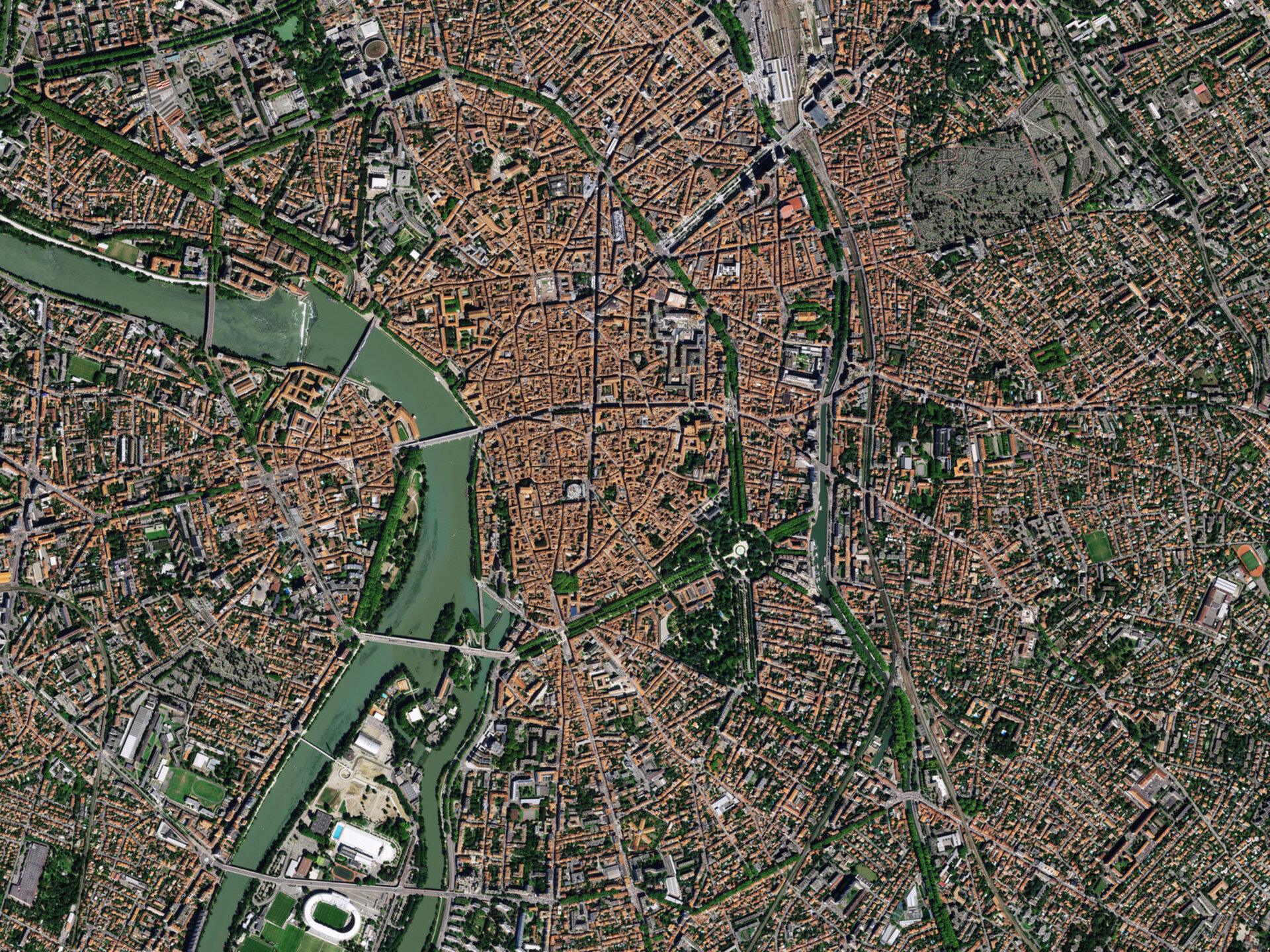
The European Space Agency (ESA) has unveiled a stunning, high-resolution image of Toulouse, France, captured by the Pleiades Neo satellite mission. This aerial perspective reveals the city’s iconic terracotta rooftops, which have earned it the affectionate moniker ‘la ville rose,’ or the pink city. The image, with its remarkable detail, offers a unique vantage point to explore the urban landscape and natural features that define this vibrant part of southwest France.
Rivers, Canals, and Stadiums from Orbit
Dominating the view is the Garonne River, gracefully winding its way through Toulouse’s city center. Originating in the Pyrenees, the river flows towards its estuary near Bordeaux. Several bridges are visible, gracefully spanning the Garonne and connecting to the Ile Du Grand Ramier, a cluster of river islands. South of the city center, the distinct white oval of the Toulouse Stadium stands out prominently. The image also highlights the city’s intricate network of canals, including the Brienne, Midi, and Garonne canals. Further details visible from space include the Matabiau railway station, a significant transportation hub, and the tree-lined avenues surrounding the historic University of Toulouse, situated near the picturesque circular Boulingrin public garden.
Unveiling Urban Details
The characteristic red hues of Toulouse’s rooftops create a dense, warm tapestry across the city center. In contrast, a stark rectangular area to the left of the image, near Matabiau station, appears almost grey. This is the city’s historic cemetery, Terre Cabade, offering a poignant visual counterpoint to the bustling urban life. In the upper-left corner, the Toulouse congress center and its accompanying Japanese gardens are also discernible, showcasing the diverse elements that make up this dynamic city. The Pleiades Neo mission, with its two satellites launched in 2021, provides Earth observation imagery with an exceptional resolution of up to 30 cm, enabling such detailed and captivating views.